
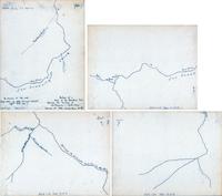
Map tracing of boundary line between San Francisco & Santa Clara Counties, 4 parts
1 / 1
AER-124p_SM-SC county boundary.tif (678.25 MB)
- Title
- Map tracing of boundary line between San Francisco & Santa Clara Counties, 4 parts
- Description
- Tracing of a portion of a map in the Division of State Lands, Sacramento. 4 pages of tracings together constitute the map; pen on tracing paper - 8.5 x 11 pp. Digital Master joins all 4 images.
- Format
- Art|Photo
- Storage Location
- Photo files
- Date Created
- probably Oct. 1853
- Identifier
- AER-124
- Provenance
- AER-124d
- AER-124p
- Other Comments
- BW mounted. Encapsulated
- Legacy Collection
- 2026 Database
- Collections
- Aerial View
- Comments
No comments yet.