
Normal Geodetic Vertical Datum of 1929
1 / 1
MAP-007c2d map.jpg (3.06 MB)
- Title
- Normal Geodetic Vertical Datum of 1929
- Description
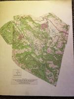
- Topo map of El Corte de Madera Rancho with boundaries drawn on modern topo map;
- Format
- Map|Photo
- Identifier
- MAP-007
- Storage Location
- Drawer 4
- Date Created
- 1929 and c 1960s
- Provenance
- MAP-007 c1
- MAP-007c2d
- Legacy Collection
- 2026 Database
- Collections
- Maps
- Comments
No comments yet.